Tuesday, May 4, 2010

Grand Canyon Rim to Rim to Rim April 18th

"To stand upon the edge of this stupendous gorge, as it receives its earliest greeting from the god of day, is to enjoy in a moment, compensation for long years of ordinary, uneventful life."Stoddard, John 1898

Here are few photos from a crazy trip to the Grand Canyon on April 18, 2010. We had come to do a “Double Crossing” a Rim to Rim to Rim run. Starting on the South Rim at the South Kaibab trailhead (elevation 7200’) down 7 miles to Phantom Ranch on the banks the Colorado river (elevation 2400’) then 14.2 miles up Bright Angel Canyon on the North Kaibab trail to the North Rim (elevation 8250’) and then turn right around and come back. As a reference it is 10 miles as the crow flies from the South Rim to the North Rim Trail Head.

This is somewhere everyone should go. It is breathtaking and awe inspiring. The size of it all is indescribable. The photos show a little sampling of how the day went.

Here is a little overview of the scope. The yellow line is a poor representation of the trail, there are about a 100 more switchbacks than are shown.


We started at 3:45 am.

Here we are lights a blazing, Troy (me) Kent, Larry, and Dorrel (just getting in the picture as the timer goes off, that is really is best side, honest.)

Headed up it is starting to get light, the North Rim far off in the distance.


River crossing! Time to get wet or go around.


Cottonwood Camp, just before the sun really starts to come out. Water stop, I fill my bottles and see a few other trail runners headed up.


Alternate forms of transportation. Tempting I tell ya very tempting. But I am having too much fun running this.


At the Caretakers Cabin, get a little water, play a little hoops. Crosstraining. Last chance for water on the way up, fill the bottles and the tank.


Looking back towards Roaring springs.


Going up, you can see the North Rim up high. But where is the trail? It is there, just can't tell it is a trail.


A nice little bridge to cross.


Looking back down from where I came. The trail meanders all over.


Many places along the way to get a refreshing shower to escape the heat. Right on the trail.


Another little waterfall crossing the trail.


All the sudden, SNOW, and not just a little, man it feels nice. I am about 1.5 miles from the rim and most all of it is snow covered. A little post hole here and there. But overall firm footing.


Coconino Viewpoint, not too far from the top, still lots of snow at this elevation. Pretty view.


Made it to the trailhead at the North Rim, where there is just a little bit a snow. 21.5 miles down, 21.5 miles to go. Still smiling.


Supai Tunnel, if you can't go over it or around it, go through it.


This is a spooky section of trail coming back down the North Rim. Going up, I needed someone to hold my hand (and no one was around) if you are afraid of heights this section will get your attention. Coming up I was caught a little off guard and wow the drop off is amazing. The trail is cut right into the cliff face.


My ride finally arrives! Not really they were doing some work on the pipeline and they were hauling equipment up and down the canyon.


Headed back into "the Box" a really cool tight little canyon along Bright Angel Creek. I am now seeing areas that I covered in the dark hours earlier.


A little bit of heaven (shade) as I head into Phantom Ranch.


Here I am at Phantom Ranch for a little pit stop, the Cantina has lemonade and limited food, so I got me a Snickers bar and 2 lemonades to go. 35 miles done and I am feeling okay, it is hot, 90 degrees. So I drink up and hit the trail. Time to cross the river I crossed in the dark.


Here is one of two ways to get across the Colorado. The Black Bridge. It is a really cool suspension bridge. I couldn't even begin to get it to sway, I tried, my 210lbs was not enough.


Making my way across, the planks in the middle are for the Mule teams to walk on, they tear the wood up, it is concave and that isn't dirt is wood that has been scraped out by the horseshoes, or mule shoes. Either way it is there for them and not me.


Step inside the real fun is about to begin. It is all up from here. 5000' of it.


The views are spectacular going up the South Kaibab trail.


A little piece of the South Kaibab Trail going up.


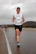
Made it! Here I am with my new friend Adam from Colorado, we played cat and mouse all day to the top of the North Rim. Then we pushed each other up to the top of the South rim and our goal of the South Kaibab trailhead. You can see from the salt stains in my shirt it was a hot day and a long pull up that hill.


An excerpt from the sign in the background, posted at the trailhead. Rim to River and back is a very tough 14 miles. Obviously we weren't too worried about sickness or death.


The Park service does everything they can do discourage what we did. They will not provide info as to conditions or if water is or is not available. This is all to avoid risk or liability which now a days is a huge concern. Although I find it terribly ironic that at the cantina they sell rim to rim t-shirts (yes I bought one I earned it, twice) showing mileage and highlights. Concessions rule.

It is my opinion that if you are going to the North Rim and back there is less chance of illness or death. Because you are already out of your mind to think that you, could, should or would want to do such a thing. It was a great experience. I hope to be able to do it again. It was very tough and amazing. I am not fond of heights and it is the perfect place to tackle that fear head on.

South Rim to North Rim to South Rim is 43 miles, Adam and I got done in about 14 hours. 3:45am - 5:45pm.


Here we have Larry and Dorrel, they both got 22 miles in and are all cleaned up and happy to see me alive.


Thursday, September 17, 2009

Wasatch 100 Mile Endurance run Sept 11-12th

The day is about to begin. My buddy Wayne picks me up at 3:30 am to get to the bus pickup at 4am at the Marriott. We get there in time to load em up and move em out. We have all our gear, packs water bottles, drinks everything we think we need to get us to that first aid station. First of all everyone has to give me a little trouble about getting lost, the past two races and on one long training run I have gotten of course and put in a few extra “bonus” miles. Scott reminds me to watch for flagging, I of course say “flagging, what do you mean, I don’t know what that is” Gary tells me the race is in the bag for me, but will I be doing 105 or 110 miles? I am on a bus full of Comedians not runners. Then we are off on a nice comfy ride to the starting line in Kaysville.


5am start time Kaysville, UT
261 runners in every shape, size, and form are ready to tackle 100 miles. With John Grobbens instructions we are off headed north up the trail. Wayne gets us a good start and we are in a group moving at a nice pace. Then all of the sudden someone yells “WRONG WAY” 30-40 of us have taken a wrong turn and went right instead of left. Oh no the “Troy” getting lost curse has followed me to Wasatch. Well at least it wasn’t me who made the wrong turn, we got it out of the way early, and we didn’t get too far up the wrong trail. I was just following everyone else in the dark. So Wayne and I along with everyone else, get back on the trail only to find we are now near the back and behind slower paced runners. It is a futile attempt to pass on the trail as it is too narrow to pass and “Chinscraper “is upon us. We are in a pack of about 20 runners as we make the ascent. Whomever is in the very front slips, nearly falls, sends a rock down, and brings the entire procession to a complete stop. All of the sudden we have traffic jam on a nearly vertical wall at the top of Chinscraper. I am looking to find something, anything to grab onto that is firmly attached, and there is nothing, so I try to keep my feet firmly planted to keep from backsliding down into Wayne or anyone else. I find a hand hold for a minute and after what seems like forever we get moving again and up over the top. Whew that was spooky! We get to Grobben’s corner at about mile 13, (a water only stop) fill up our bottles and head for Francis peak.


Francis Peak Aid (Mile 18.76) Larry is waiting and has everything ready for me. I am feeling really good and it is a beautiful day. Nearly 19 miles completed. Off to Bountiful B Aid (mile 23.95) I don’t remember much other than it was getting hot. The trail could have used some work but it was a good stretch. Wayne and I got into the aid station in good shape.
Next up Sessions Lift Off (mile28.23) I wondered about the name but I know it is called that for a reason. It is a launch pad, you are low and you have to go high. There are 4 nasty climbs through brush and poor to nonexistent trail it is difficult and very unpleasant. I lose Wayne along here somewhere during the climbs, and then he catches and loses me. Lots of overgrowth made this section not only memorable, but something I would like to not like to experience again. We get to Swallow Rocks aid station (39.4) feeling really good Wayne catches me there we grab a Popsicle (yummy) fill our bottles and leave together. There is a climb out of Swallow rocks and Wayne tells me to go on up the climb. I am feeling bad about losing Wayne but feeling real good physically and run most of this section as it is slightly down hill. There is a slight breeze and it is hot so I take it easy and enjoy the ride.


Big Mountain (mile 39.4) there are tons of people cheering and cowbells clanging. WOW. Not what I expected. All the other aid stations just had a few volunteers. I weigh in; I am up a few pounds at 209, very good that means I have stayed hydrated. Larry grabs me gets me my stuff I slam an ensure, fill my bottles, grab some goodies from the aid station table, then I remember I need to pick up my pacer Kelly Snyder. I ask Larry where is Kelly? He says you got here faster than your projected time and he is in the bathroom, oops. So I wait a minute and there he is. I grab him and we get out of there. I see Wayne coming down the hill. Go Wayne. I am happy to have Kelly; we take out of there and get a going. It is a real nice stretch through here. We run the ridgeline for quite a ways. It is a long stretch between aid stations and I am out of water and starting to not feel too hot. Kelly keeps me going by giving me some of his. We get to the next aid station Alexander Ridge (mile 47.44) we fill up I get some bananas and food. Off we go. I am starting to feel better and we get moving. Kelly does a real good job of getting out in front of me and pulling me along. We talk, run and enjoy where we are. We go up over Rogers’s junction and can see Lambs Canyon. Trouble is it is 3 miles away. I hate seeing where I need to be, but knowing it will be a while before I get there. We can see that there are lots of cars and you can hear the people cheering. We need to get there before dark and we are cutting it close it is nearly 8 pm. I start to feel a little woozy again, but I stick with Kelly and I keep drinking and take my salt pills. Just as we get to the Lambs Canyon aid station (mile 53.13) I am starting to feel better. And wow, tons of people there, Carl, Larry, Arb, Shay, Steph and all of Wayne’s family to greet me. Shay promised to have ice cold Chocolate milk for me at the finish. How is that for motivation? Wayne is not far behind me, he comes in everyone gets to work on him. Larry goes to work I get new shoes, socks, shirt, eat some stuff, get my light, my hat, and some warm clothes. You would think this was NASCAR. Kelly gets me an ice cold PowerAde, I drink up, Wayne and I leave together with our pacers headed up Lambs canyon.
Kelly and I start to climb up the canyon, I really am feeling good and the cool night air is a welcome change. We are on pavement for 1.67 miles then back on the trail. We get in the groove and start to power up, we settle into a good solid pace. It was really fun. As we come over Bare Bottom pass we can see the lights of the valley in the distance. Down Elbow Fork and we are back to a paved section in Millcreek canyon. The pavement is nice change and Kelly and I get after it. 3 paved miles later we arrive at Millcreek Upper Big Water trailhead (mile 61.68) at ten minutes to 11. There are tons of people again cheering. I get my warm clothes on it is 45 degrees. By the time I leave I am shivering cold. I thank Kelly, he was huge for me he kept me going when I was down, and pushed me hard when I was up. I could tell he wanted to continue with me, but he had put in 21 miles and it was time for me to make the switch. Many thanks to him for a fine job pacing me through a great section.


I got what I needed at the aid station and Vince my next pacer was ready to go. I arrived a little before projected time and so Vince didn’t even get to sit down before we were ready to go. This is a section of trail I know well from training here so often. I am very excited about it. I take Kelly’s advice and keep it steady. Vince and I make it to the Desolation Lake Aid (mile 66.93) it is 12:38 am and it is triage here, people asleep in sleeping bags, people all around the camp fire with their heads in their hands. I fill my bottles and get gone before it becomes contagious. We head up to Red Lovers Ridge, I pause and look up to the stars and remember to be thankful to be alive. It is dead quiet and surreal, a defining moment. I say goodbye to the lake and traverse to Scott’s pass aid at (mile 70.79) I pull in get some soup and it is amazing. I get one more cup of soup and we head down Puke hill to Guardsman pass and onto Brighton. Vince my pacer does a great job and we arrive at Brighton (mile 75.61) at 3:13am.


All the advice I got about Brighton aid was to get in and get out as fast as possible. It is warm inside and some people never leave. So I run in, let out a yell WOOOO! Weigh in at 204lbs, get my drop box, reload, refill, brush my teeth (thanks Mark Collman) wash my face, answer natures call and I am out of there with a yell in 10 minutes (just like NASCAR). I also pick up my next pacer Tommy Thiede. He asks are you ready, I say heck yeah let’s get up this mountain. We power up to Point Supreme (highest point on the course at 10,400) we get to the top and there is a guy hanging out cheering us on at 4 in the morning. Amazing and very cool. We head down to Ant Knolls aid and that is where I make a huge mistake. I sit down. I start to feel nauseous and think I am going to puke. I eat some crackers and anything else I think can to stifle this. Nothing works. I look at Tom and think I do not want to puke that will really mess things up I had just filled my tank. So I decide I have to get up and get going. I figure if I puke I puke, I got to get going. Not too long later, I am feeling good again. I tell Tommy, don’t let me sit down ever again, no more of that. We make it up the Grunt and get to Pole Line Pass Aid
(mile 83.39) I have friends working here and so I let out a yell, to let them know that runner 176 is here and he is hungry. I get my needs met, take a couple pictures, a hug from Colin and we are on our way. It is 6:28am and I am about to see the sun rise for the second time. I have been lapped by the sun. As we make our way to Rock Springs aid (mile 87.39) we are in some of the prettiest areas. We have a great view of the back side of Mt Timpanogos. Unfortunately the fun is about to end. Up next we have the Plunge and the Dive. Two very nasty downhill sections that are just plain no fun, motorcycles have been using the area as a widow maker hill climb training area and the trail is a rut filled with rocks and flour type dirt. I fall many times try to break my ankle many more times and eventually we make it to Pot Bottom aid (mile 93.13) it is 9:44am. I am starting to feel some real fatigue, up to this point I have been upbeat and motivated, so I refill my bottles get some encouragement and Grandmas cookies from Olaf and head up out of there. I start to think that I may not get done, I am hurting more than ever, my feet are trashed and I can tell I have some blisters in areas that I have not had before. But I let Tom pull me down the hill it is a rocky piece of road that is not helping my state of mind; it is a slog towards the Maze. We get in the Maze and it is like we will never get out, I hear golfers and can tell we are close to the pavement, but it seems to take forever to get to the road. Then I realize, as I get to the pavement, that I am going to finish, I am going to drag my worn out feet and butt to the finish and we do just that. I run the last ½ mile and finish my first 100 mile run at 30 hours 59 minutes. Un-freaking believable. I shake John Grobben’s hand and I thank him for a very well organized event, it was exactly as described, “100 miles of Heaven and Hell”. Words cannot accurately describe what happened or how I feel. Happy sore muscles.
.

Katcina Mosa 100K

The Katcina Mosa 100K. What a day. 20 Hours 75 ish miles, 17,510 of elevation. You say 100K is not 75 miles it is 62 miles. And you are right, but if you get off course and follow someone elses orange markers for a ways, you can make a 100K into a 75 mile run without too much trouble and that is what I did. Here are some photos from the the fun.

This is headed up to Lightening Ridge, right in the middle top is where I am headed. 2500’ of elevation in 3 miles.


That is Lightening Ridge, tons of flowers it was a beautiful morning, #35 never saw me again.


Getting ready to make the traverse across the ridge, sun’s coming up looking north.


Trail heading north, dropped down into the saddle and then it was a downhill slide to Big Springs aid station at mile 24


Looking down, back side of Lightening ridge, Big Springs here I come.


Headed up towards Windy Pass


Wayne giving me the big thumbs up! Windy pass is in our sights.


I am happy to get this climb done. Looking pretty good for 30 miles under my belt. What a great day.


Looking towards the back side of Mt Timpanogos we started down in the meadow, 3200’ vertical and 5 miles ago.


Here we go. A picture near Dry fork, this is where we got of course 62 just wasn’t enough for a couple of over achievers like Wayne and I. 75 miles is a lot.


Here I am at the finish with John Bozung the race director who organized this debacle. Finisher !


This I what my dirt tan looked like once I peeled all my clothes away. It was worse than it looked.


Now you know what a pair of legs and feet look like after 20 hours and 75 miles. Sexy!

Wasatch Speedgoat 50 K

This race is touted by it's creator as "the toughest 50K in the US". And I believe it. With all the elevation and topping Hidden Peak (11,200) twice, there is no disputing it.


Here I am slip sliding away using my size 12's for ski's. It was that kind of course.


It was a excpetionally beautiful Mountain course with great views.


It was a great day and I was happy to finish under 10 hours.


Monday, June 8, 2009

Squaw Peak 50 Miler

Squaw Peak 50 Mile June 6, 2009
I was very excited for this race. Having 14,000 of uphill elevation and some very serious climbs. I saw it as a warm up for Wasatch. So I was prepared for a tough day. Little did I know I was in for a humbling experience. Here is a view of Provo and Utah lake looking west about mile 7 outside of the #2 aid station at Hope CG. I had sprained my ankle on the river trail at about mile 1 and was really not in the best of spirits. It was a real tough break and I was tempted to go back to the car and call it a day. But since I had come with Scott I had no keys and it would do me no good to sit and wait at the finish. So I went after it. It was quite painful for the next 10 miles and it never seemed to loosen up.


It was all single track trail and it was real tough to run the downhill. I took some vitamin I and stayed on it. Here is a view from Aid Station #3 at mile 15.6. There was a long downhill section here and it was very rocky, I struggled all the way to Aid station #5 at Mile 21. We then had a section of pavement up Hobblecreek Canyon and it was a gift for my ankle, I was able to run the pavement and loosen things up a bit. When we got to Lower River Aid station #6 at Mile 26.5. I was feeling pretty good and the ankle was not so tight and painful. I hammered the uphill knowing that I had to get to get to Aid station #8 before 2:30 pm to make the hard cut off.


At Aid station #7 at mile 29.5. I had a drop bag here and so I reloaded with my amino and GU and got on my way as quickly as I could. It was 12:15 and I had a hour and forty five minutes to make the 2:30 pm cutoff but it was only 4 miles away I knew I could make it with time to spare. I knew it would be a tough haul because the second half of the course is tougher than the first half and elevation would be an issue as we were going to be near 9800' for a while.


Right out of the aid station the trail got real tough, but it only lasted for about 3/4 of mile


I got to the Little Valley Aid Station at mile 33.5 at 1:45 45 minutes before the cutoff and I was feeling pretty good the ankle was sore but runable and I refilled my bottles and got on my way. Larry Emery was there and he was doing well also. I hooked up with another runner and we took out of there headed for the worst part of the course Windy Pass. We settled into a good pace and were moving along well. All of the sudden we came to a T in the trail and we had to go left or right. But there were no flags indicating which way we were to go. We had gotten off course, and now we had to back track and see where we went off. We headed back down everything we came up and according to Bobs GPS. It was a mile and half out of the way, so we turned a 7 mile section into a 10 mile section between aid stations. We got back to the trail and came up on the sweep crew, we were DFL (dead freaking last) they thought they had all the runners in front of them. We explained that we were stupid and got of course. I asked if they had any water to spare and got a little, I was down to 2 bottles and I knew I was going to need 3 to get over Windy. Bob and I kept plugging along and passed quite a few folks, some not doing so well others just like us cruising along. It seemed to take forever to get to the bottom of Windy Pass. Bob took a food break and I continued on knowing that he would catch me on the downhill side.


This photo shows Windy pass in the distance we followed the snow line up and around. It was a very difficult climb. One guy called it "puke hill" I didn't puke on the hill. I waited till later.


Here we are on the downhill side of Windy Pass headed for Aid Station #9 at mile 41 by the time I got there I was in pretty bad shape feeling sick and I knew I was dehydrated. Jim Skaggs was manning the station and had some ginger chews and I chewed on one got my bottles full and got out of there. I took some S-caps and drank a full bottle of water. I was feeling pretty good and I knew I needed some GU. So I rip out a GU and do the usual sip and run, then all of the sudden I am going to puke, and I do, all the water and GU and S-caps are now on the trail. I am in big trouble. Bob takes a S-cap and cracks it open and puts it on my tongue. That seems to help and so I go back to sipping water and take a couple more S-caps. We get going and I am feeling okay not good but okay. I slow some and let Bob go as he is much faster than I am on the downhill. I wish him luck and tell him I will see him at the finish. I go about another mile and I am feeling real bad again. I don't dare take any GU and I am out of S-caps. So I stop sit down and I take my last bottle of water and mix up some Amino, then take some small sips as I try to get going again. I remember that in our goodie bags they gave us some electrolyte strips, so I take a couple and I sip my Amino, take a couple Ibuprofen and after a mile or so. I am feeling normal again. But now I am out of water again and not sure where the aid station is. So I very conservatively run till I hear Troy! And Scotty K is at the aid station, so I run in as fast I can get my bottles full again and here I am leaving Aid Station #10 Mile 46.9 or 49.9 for me because of the scenic detour. I am feeling real good even though my eyes are closed in the photo. I am not terribly photogenic at this point in the day.


I made it to the finish running the last 3 or so miles feeling really pretty good. What an amazing change from where I was not too long ago.

Here I am at the finish explaining how Bob and I got 53 miles in
instead of the recommended 50. It was a very wild day, with many ups and downs. I am humbled by the experience and it really was a test as to whether I can even begin to think about tackling 100 miles. You find that little mistakes can be very costly. 3 extra miles cost me big. Had I not made that detour I beleive I would not have gotten sick and would have been done hours sooner.